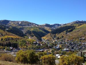
Good question, and there are several answers! There is Old Town, Park City proper, the Park City school district, those areas with a Park City mailing address, and the Park City “area”. People within each of these areas often consider themselves to live “in Park City” (me included!) though some people may disagree what areas should be counted as being within Park City.
When many people think of Park City, they think of the old mining town area of Old Town and also the ski resorts. Others think of “Park City proper”, the incorporated city in Summit County, Utah , that has about 8,000 year-round residents. It is comprised of the area ranging from Deer Valley to the south, Park City resort to the west, the McPolin Farm White Barn and Park Meadows to the north, and US-40 to the east. Park City has its own government and services including police, building inspectors, etc. For the most part this is the area of ZIP code 84060. But many other people say that they live in Park City too.
Broadening out, we have the boundaries of the Park City School District. The Park City School District is comprised of the entire area of western side Summit County, Utah. In addition to Park City proper, we add the areas north up to and beyond I-80 and along I-80 from the Parley’s Summit exit neighborhood of Summit Park to the west and Silver Creek and US-40 to the east. This expands the population to about 30,000 full-time residents. The areas of Summit County outside of Park City proper are served by some separate county services such as the Summit County Sheriff’s Department.
Broadening out further, there are additional the areas within ZIP codes 84060 and 84098 that add neighborhoods like Promontory, Silver Gate Ranches, and the future development Silver Creek Village, which will be across I-80 to the southeast from the Silver Creek neighborhood and east of US-40. Those neighborhoods have a Park City mailing address, but are in the South Summit (County) school district.
Finally, there is an area which could loosely be called “the Park City region” which includes all of Summit and Wasatch counties. This definition adds “eastern” Summit County, which locally refers to the eastern part of the populated area of Summit County, all of which lies geographically in the extreme western part of the county. The vast majority of the area of Summit County is very remote land in the Uinta Mountains, mostly national forest land. The communities of Kamas, Oakley, Wanship, and Coalville lie in eastern Summit County. The North Summit School District serves the northern part of eastern Summit County including Coalville, Hoytsville, and Wanship while the South Summit School District covers the southern part of eastern Summit County including Oakley and Kamas. These communities are about a 20-30 minute drive to the ski resorts and Old Town, and about a 30-45 minute drive to the SLC airport.
This definition also might include Wasatch County, Utah including the communities of Heber City, Midway, and Hideout as well as neighborhoods such as Red Ledges and Timberlakes. Wasatch County has its own school district. Though local residents would refer to these areas by their individual community names rather than as being part of the Park City area, all are within 45 minutes of the Park City ski areas and an hour of the Salt Lake City airport. This area comprises most of the area sometimes called the “Wasatch Back”, a name sometimes used to distinguish our mountain valleys from the much more heavily populated “Wasatch Front” region of the Salt Lake City, Provo, and Ogden valleys.
The Park City Multiple Listing Service (MLS) and the Park City Board of Realtors cover all of Summit and Wasatch counties, so we are ready to help you with finding your dream property whether it’s near the ski areas, in Old Town, in Park City proper, in the Park City School District, has a Park City Mailing address, or in a nearby community. Give us a call to help you get started!


Leave a Reply